You might have wondered how exactly Google Maps work? There was a time when we had Atlas, Globes, or paper maps for studying the maps of a particular area. If we had to travel somewhere, we used to rely on the local people who would help you navigate to the location.
But not anymore. For travelers, Google Maps is a blessing in today’s world. Each and every person with an active Internet and a decent device can easily find out the locations accurately.
So, the question is, how Google maps exactly works? How does it indicate the exact pinpoint location of a particular place? Also, how did it come into usage?
Why Google Maps was made?
Google Maps is just a service based on the Global Positioning System (GPS). History comes about GPS. GPS was first made by the USA in 1973 for navigation and tracking of its military services. However, it was not very accurate at that time.Earlier it was called NAVSTAR (Navigation System with Time And Ranging Global Positioning System). It merely used to track ships, aircraft, missiles, and other military-based services of the USA.
Finally, in 1995, GPS became available for common citizens of the USA after making the necessary changes. Now, GPS got much secure and accurate with positioning.
Many applications turned up that worked on GPS. In fact, many similar services came into existence like GPS (United States), GLONASS (Russian Federation), Galileo (European Union), Compass (China), NAVIC (India), and QZSS (Japan). Based on that, Google Maps was born in 2005.
How GPS works?
For working accurately in harmony, GPS uses a constellation of 24 satellites that keep on revolving around the Earth.The placement is in such a way that 6 orbits of period equal to 12 hours. Moreover, the spacing is at 60° apart from each other.
To determine a particular location, GPS uses the triangulation method. This means that 3 satellites will work together to determine the exact location of an object. Even if one of the satellites in the existing trio fails to fetch the location, the other satellite takes up the place.
After compiling the data of 3 satellites, we get the exact location. One more satellite is used which is required for removing the error as well as determining the height of the object.

How Google Maps work and how it finds out the information about objects?
After a considerable amount of images from satellite, Google had a challenge of labeling the buildings, roads, monuments, spots, etc. So, how would Google label those blank map images obtained from satellites?Several Governments and countries came together for this revolution. Google asked for permission to get the local data. After all, who would better provide the local data other than the local Governments?
Google gathered all the massive amounts of data and used all of it to create Google Maps. This is how the company got all the names of roads, important buildings, etc.
Some countries don’t get to use Google Maps because they denied providing the data.
Google Street View
Satellite images are fine but Google wanted even more precise details of every street and corner.Now, Google started using Google cars for clicking the 360°
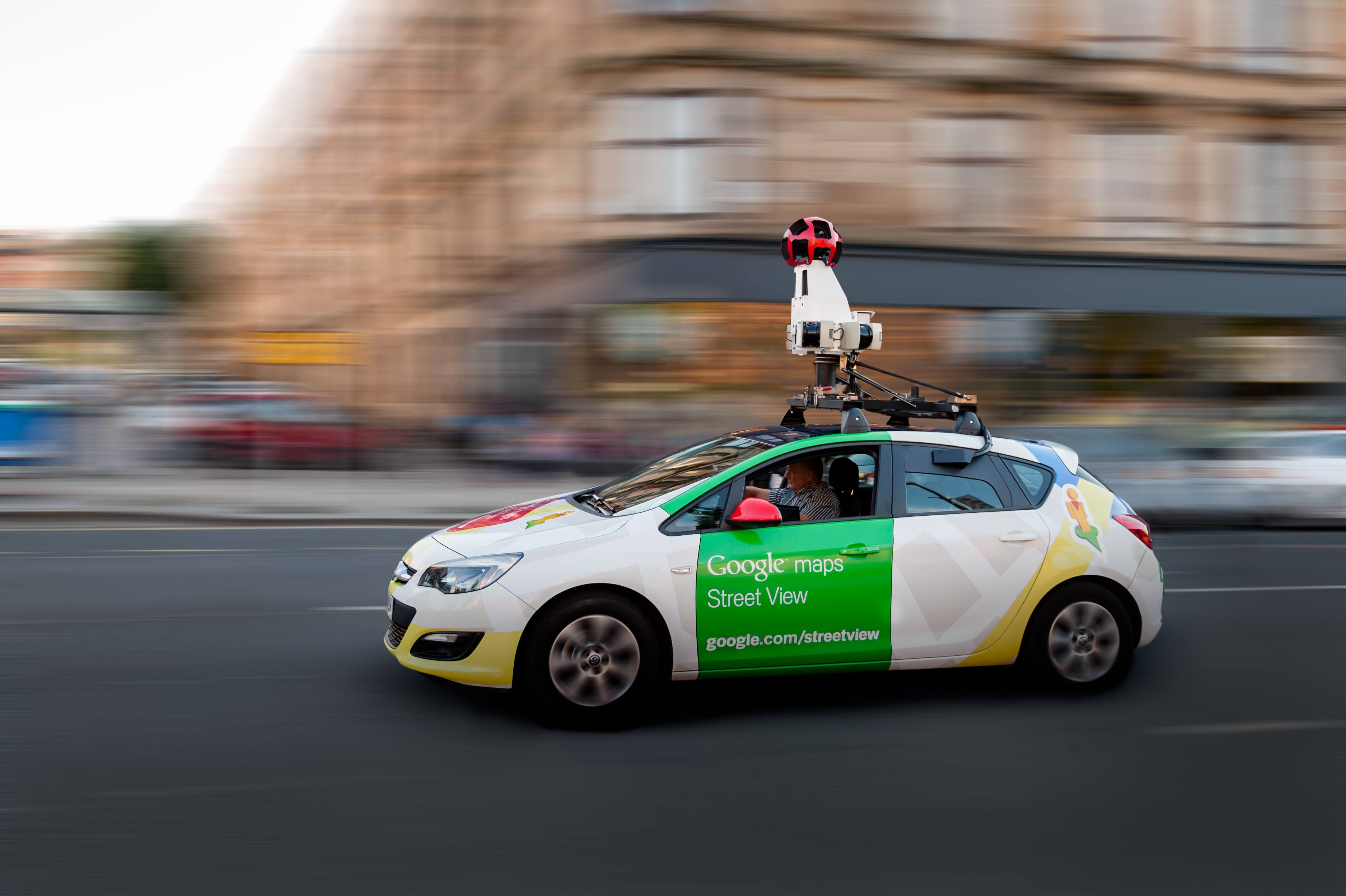
Unfortunately, the Indian Government did not allow Google Street View because of privacy reasons.
Google Local Guides
Not only the Government, Google Local Guides is a strong program where users contribute pictures, locations, and various details to Google.Furthermore, Google Local Guides get various perks from Google for their contribution. This is how Google keeps gets updated data.
Well, I am soon turning out to be a Level 8 Local Guide. Wink Wink 🙂
How does Google know about live traffic on roads?
Now your next question might be that if important locations are provided by Governments and other details are provided by users then how does it know about the traffic updates?How Truecaller Works? How can it find out the names of unknown numbers?
Google Maps works the same way. People themselves provide the data on traffic. Even you are one of the contributors. Surprised?Whenever a large number of people are moving in a car and they all are using Google Maps, their GPS (location) is turned on. You don’t even need to use Google maps. If your location is enabled, your complete data is reaching to Google.
Now Google is smart enough. If so many people are going at the same speed, the road must be responsible for it. If all vehicles are moving slowly, there are chances of high traffic. Likewise, if the vehicles are moving with good speed, the road is absolutely clear.
As a result, Google Maps knows everything regarding live traffic updates. Now a new option of reporting an accident or obstacles have been added. Again, more data for Google.
Overall, you get the facility of Google Maps because of those satellites revolving you, then the Google company, and of course, people like you and me.
So, I hope now you know how Google Maps work.
No comments:
Post a Comment
Thank you for your concern please follow to get connected with us.